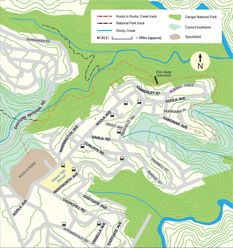
Koola Park to Rocky Creek Track

About
Start/finish: Koola Park to Rocky Creek Track
Distance: 4.3km returning to Koola Park
Difficulty: Moderate – steep, rough sections and steps
Description: Behind Koola Park is the start of a track part of Bushranger Reserve which descends for 12 metres leading to the start of Rocky Creek Track in the Garigal National Park distancing around 317 metres. Following from there in an easterly direction to the end of the track you will come out at the end of Koola Avenue East Killara for your return journey back to Koola Park, roughly a 4.3km walk. The track crosses Hawkesbury Sandstone soils with a cropping of ironstone layers, creating a vegetation community with diverse native plant species and birds to hear and see along the way.

View Koola Park to Rocky Creek Track brochure and map(PDF, 5MB)
More info: 9424 0000 or email krg@krg.nsw.gov.au.